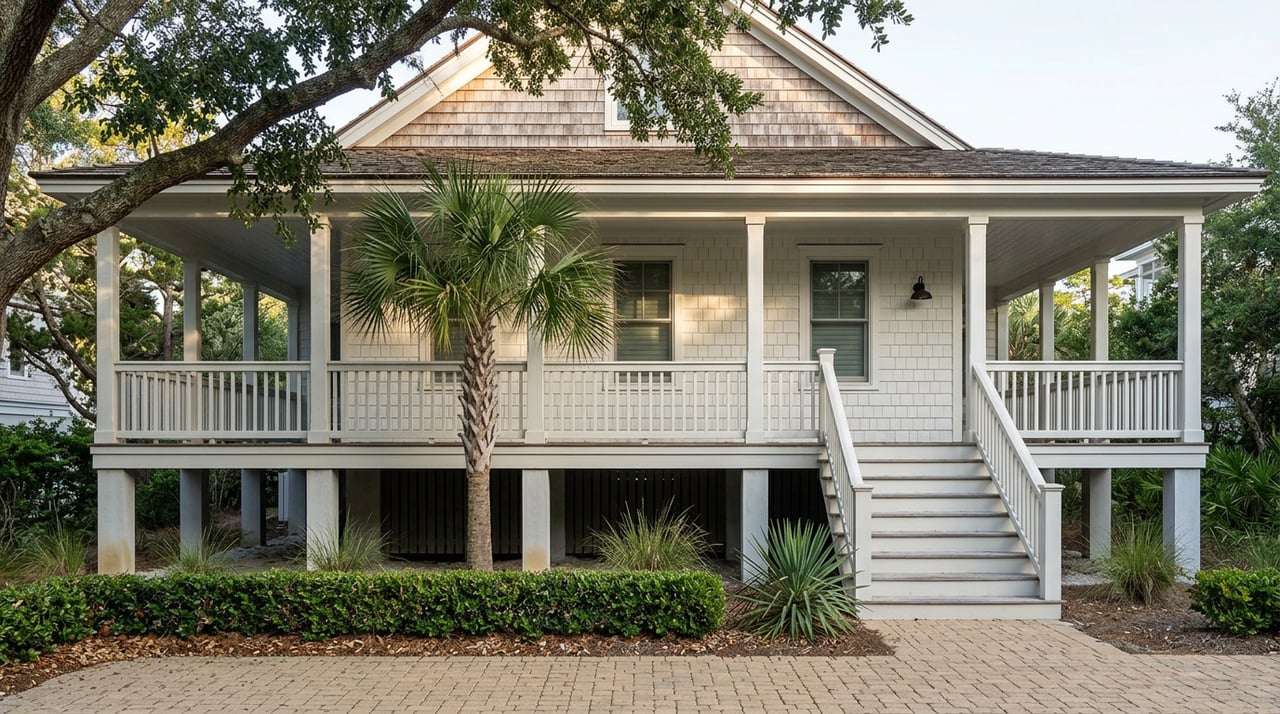
Picture an oceanfront lot on Wrightsville Beach, somewhere along the stretch between Masonboro Inlet and Heron Street. The listing shows a deed that reads the way oceanfront deeds have read for decades, describing the property line as running to the high water mark of the Atlantic Ocean. A buyer pencils out a rebuild, maybe a bigger footprint, maybe a pool, and assumes the buildable area follows that deed line.
It doesn't. On this specific stretch of the island, the eastern boundary of the lot isn't the deed language at all. It's a line the North Carolina General Assembly drew in 1939, and the Town of Wrightsville Beach still measures every setback from it today.
The line your deed doesn't show
In 1939, the state legislature passed an act tied to a beach renourishment project on Wrightsville Beach. The act split the newly built-up land into two parts. Everything seaward of a defined line became town property. Everything landward of it belonged to the adjoining owner. According to the Town's own description, this established the easternmost property line for oceanfront lots between Masonboro Inlet and Heron Street, regardless of what an individual deed says.
That second part is what catches buyers off guard. Some older deeds in this stretch still describe the lot as extending to the high water mark, language that predates or ignores the 1939 act. The Town is direct about this on its official 1939 Property Line page: even if your deed includes that description, the eastern boundary of your property is the 1939 line, not the water.
This isn't a footnote. It's the number a setback gets measured from, which means it's the number that decides how much house actually fits.
Why the setback stacks twice
Once you know where the 1939 line falls, you still have to figure out which setback rule governs from there. Two separate authorities can apply: the Town's own zoning ordinance and the state's Coastal Area Management Act, known as CAMA. The Town's guidance is unambiguous about how a conflict gets resolved. Whichever setback is more restrictive, the zoning setback or the CAMA setback, is the one that applies to anything you build.
In practice, this means a buyer can't just check one rulebook and move forward. A design that clears the zoning setback might still fail the CAMA setback, or the reverse, and the more restrictive number wins either way. On a narrow barrier island lot, that can shrink the practical building envelope by more than owners expect when they first look at a parcel.
Here's how the two situations compare for anyone evaluating an oceanfront purchase or a rebuild:
| Most Wrightsville Beach oceanfront lots | Lots between Masonboro Inlet and Heron Street | |
|---|---|---|
| Eastern boundary for setback purposes | The recorded deed line | The 1939 property line, even if the deed says otherwise |
| Which setback controls | Whichever is more restrictive, town zoning or CAMA | Same rule, but measured from a different starting point |
| Where to confirm it | Town Planning & Inspections | Town Planning & Inspections, plus the 1939 line map on file with that department |
The Town keeps a physical map of the 1939 line at the Planning and Inspections office, and staff there can tell you where it falls on a specific parcel before you commit to a design.
The 50 percent number that turns a remodel into a full rebuild
Even away from that specific stretch of oceanfront, the island has a second mechanism that changes the renovate-versus-rebuild math, and it applies to nearly every older home in Wrightsville Beach because the entire town sits in a flood hazard area.
Local flood guidance uses a 50 percent threshold for what counts as a substantial improvement. If the cost of repair, reconstruction, or additions equals or exceeds 50 percent of the structure's assessed tax value or a certified appraisal, whichever applies, the project crosses into substantial improvement territory. That threshold isn't a one-time check on a single invoice. It's tracked cumulatively over at least five years, so a homeowner who does a kitchen remodel one year and a bathroom addition two years later can trip the threshold without ever writing one big check.
Once a project crosses that line, current setback and floodplain rules apply in full, not just to the new work but potentially to the whole structure. A scope that looked like a straightforward remodel on paper can suddenly require bringing an entire older home up to today's standards. This is the number worth running before you fall in love with a design, not after a contractor has already started demolition.
The 200 square foot trigger nobody budgets for
There's a third layer, and it's about timing rather than money. If a property sits in what the state calls an Area of Environmental Concern, and the project disturbs more than 200 square feet of ground, it likely needs a CAMA Minor Development Permit before work begins. In Wrightsville Beach, the two primary Areas of Environmental Concern are the Ocean Erodible Area, which covers most oceanfront properties, and the Estuarine Shoreline, which covers most sound front properties. Between the two, that covers a large share of the island's most desirable lots.
The good news is that single-family homes typically qualify for the minor permit track, and state guidance calls for that permit to be issued within 25 days of a complete application. Major permits are a different animal entirely, potentially pulling in review from ten state agencies and four federal agencies. Knowing which track your project falls on, before you set a closing date or a renovation start date, is the difference between a manageable timeline and a stalled one.
A few other numbers round out the picture for anyone comparing renovation against a teardown on this island. The Town caps residential structure height at 40 feet, measured from the centerline of the street, which limits how much a rebuild can gain in square footage by going up rather than out. Stormwater permitting can also come into play if a project expands impervious area, driveways, patios, added hardscape, by more than 500 square feet beyond the existing footprint.
A due diligence sequence that actually protects you
None of this means renovation or rebuilding is off the table on Wrightsville Beach. It means the order of operations matters more here than in most markets. Before committing to a floor plan or a construction budget, it's worth working through these steps in sequence:
- Confirm with Town Planning & Inspections whether the parcel falls between Masonboro Inlet and Heron Street, and if so, review the 1939 line map for that specific lot.
- Ask which setback applies, town zoning or CAMA, and get the more restrictive number in writing before design work goes further.
- Determine whether the project disturbs more than 200 square feet within an Area of Environmental Concern, which would call for a CAMA Minor Development Permit ahead of construction.
- Pull the property's current assessed tax value or get a certified appraisal, then calculate the 50 percent substantial improvement threshold against your realistic project cost, remembering it accumulates over five years.
- Loop in a surveyor and an architect or builder who has worked through Wrightsville Beach's floodplain and setback rules before comparing renovation and rebuild scenarios side by side.
Skipping that sequence is how a buyer ends up attached to a rebuild concept that the lot can't legally support, or how a homeowner starts a remodel that quietly becomes a full-code rebuild halfway through.
FAQ
Does the 1939 property line affect every oceanfront lot in Wrightsville Beach? No. It specifically applies to oceanfront lots between Masonboro Inlet and Heron Street, based on the boundaries set by the original 1939 legislative act.
Is the 1939 line the same as a flood zone boundary? No. The 1939 line is a property and setback boundary. Flood zone designations and the 50 percent substantial improvement rule are separate considerations that apply based on the property's flood hazard status, which covers the entire town.
Where can I actually see the 1939 line for a specific property? The Town of Wrightsville Beach Planning and Inspections Department keeps a map of the line on file and can help identify where it falls on an individual parcel.
If you're weighing a Wrightsville Beach purchase with renovation or rebuild potential in mind, these are exactly the questions worth answering before you write an offer, not after. Anna Sillery works through this kind of due diligence with buyers and owners across the island every day. Schedule a consultation to talk through a specific property before you get attached to a plan the lot may not support.